


Professional Experience
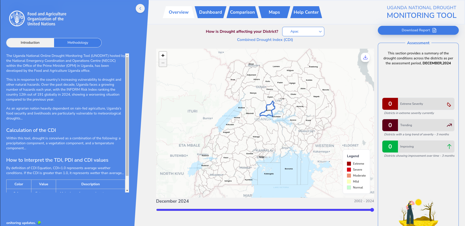
Uganda National Drought Monitoring Tool (CDI)
April 2025: GeoTechsys Africa & FAO Uganda
A WebGIS tool for monitoring drought using a Combined Drought Index derived from satellite data. Enables effective disaster response planning.
Skills:
Drought React Next.js PostGIS QGIS Modelling CHIRPS MODIS LST MODIS VIIRS OCHA HDX Google Earth Engine RESTful API GeoDjango Leaflet.js GeoServer Automated Workflows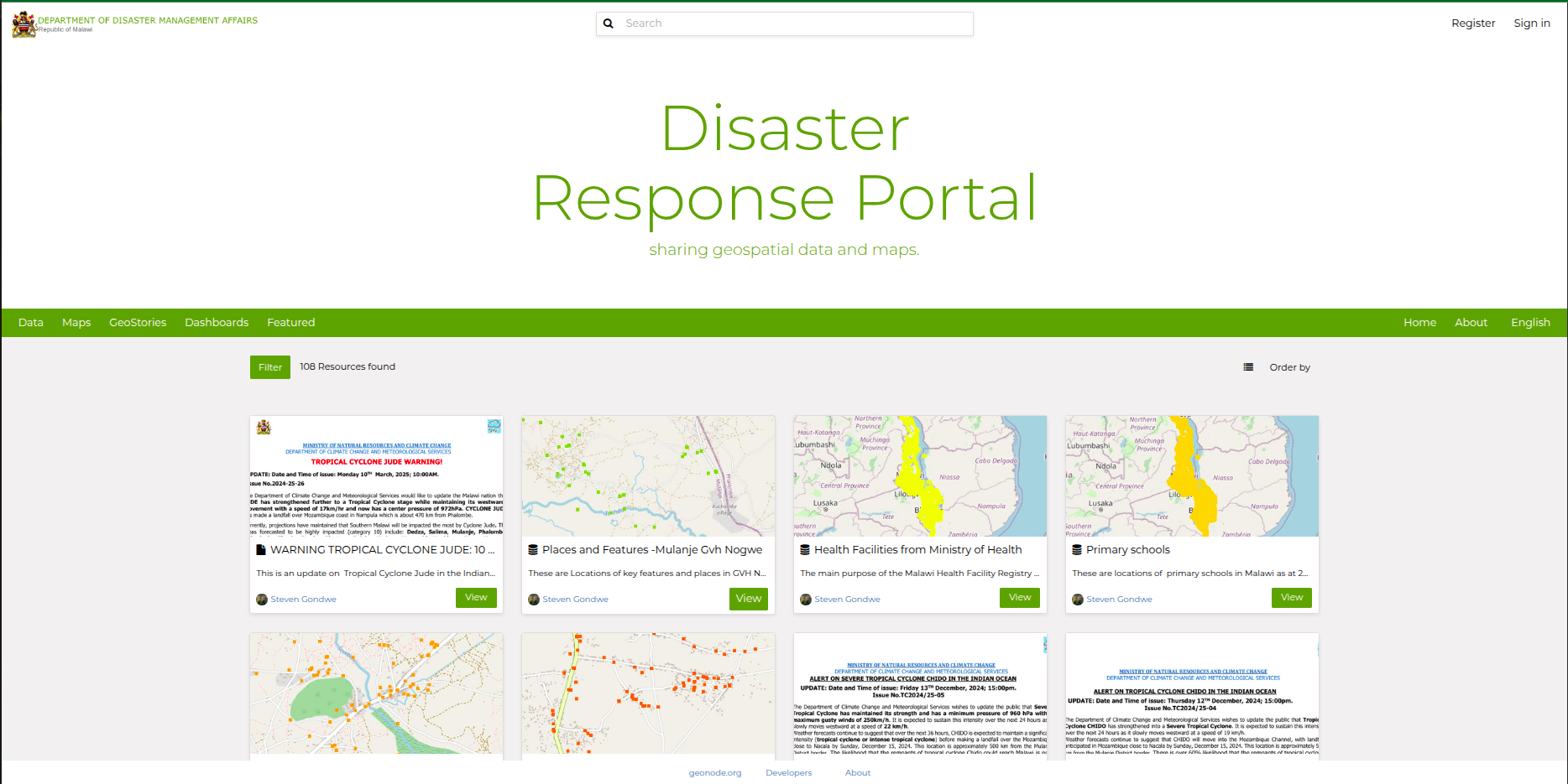
Disaster Response Portal for Malawi
January 2024: UNICEF Malawi
Disaster Response Portal for the Department of Disaster Management Affairs (DoDMA) in partnership with Malawi University of Science and Technology and UNICEF Malawi.
Skills:
Humanitarian Assistance Disaster Risk Management Disaster Assessment Capacity Building Spatial Data Infrastructure GeoNode GeoServer Leaflet.js PostgreSQL- PostGIS GeoDjango RESTful API Linux Google Cloud Platform Load Balancing Nginx Disaster Mapping Automated WorkflowsLink:
https://drp.must.ac.mw/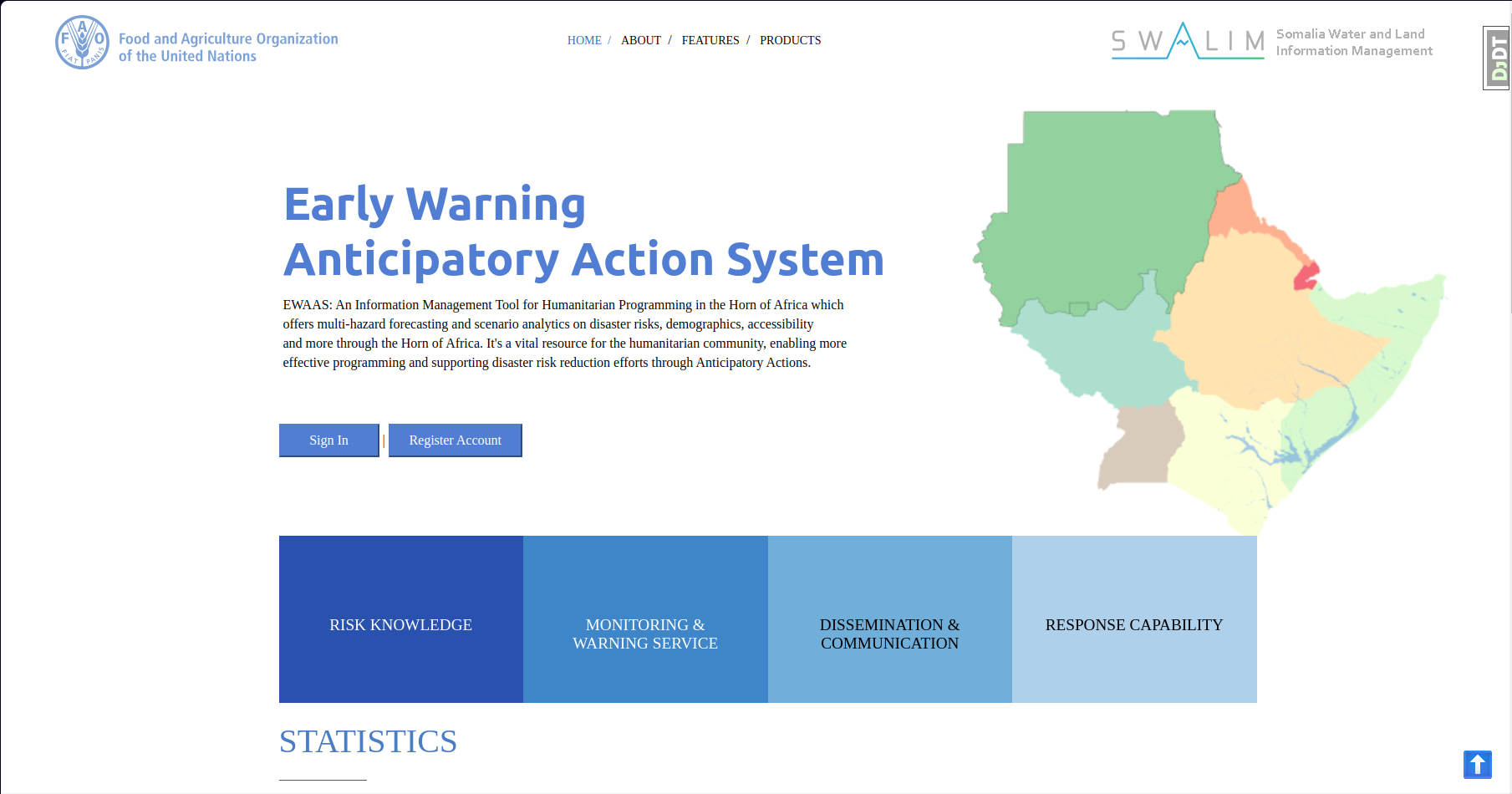
Early Warning & Anticipatory Action System (EWAAS)
July 2023: FAO RTEA & Somalia
An information management tool offering multi-hazard forecasting for humanitarian aid in the Horn of Africa.
Skills:
Hazards Floods Drought Desert Locust Python Leaflet.js ECMWF Forecast API ESA Land Cover Geofabrik OSM ODK QGIS Modelling PostgreSQL-PostGIS Google Earth Engine RESTful API GeoDjango Leaflet.js Multi-User Automated Workflows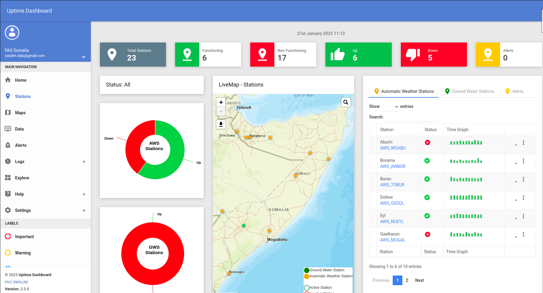
Uptime Sensor Dashboard
2023: FAO Somalia
A dashboard to monitor and visualize near-realtime weather information from Automatic Weather Stations and Ground Water Stations.
Skills:
Weather IoT Python RESTful API GeoDjango Leaflet.js Multi-User MsSQL PostgreSQL-PostGIS Automated Workflows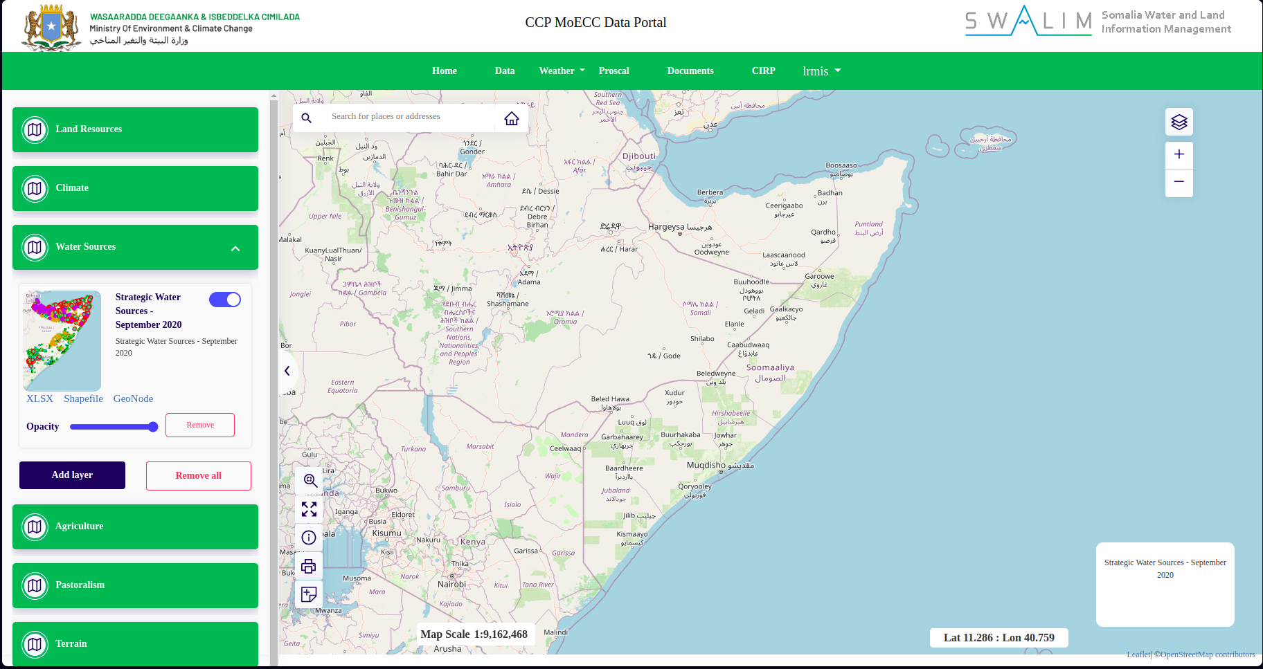
Land Resource Management Information System
2022: FAO Somalia
A WebGIS app for providing access to GIS data and organizing the flow of information on land resources and agricultural data for stakeholders.
Skills:
Land Resources Python Django Leaflet.js Spatial FAOSWALIM ClimSeries SWIMS GeoServer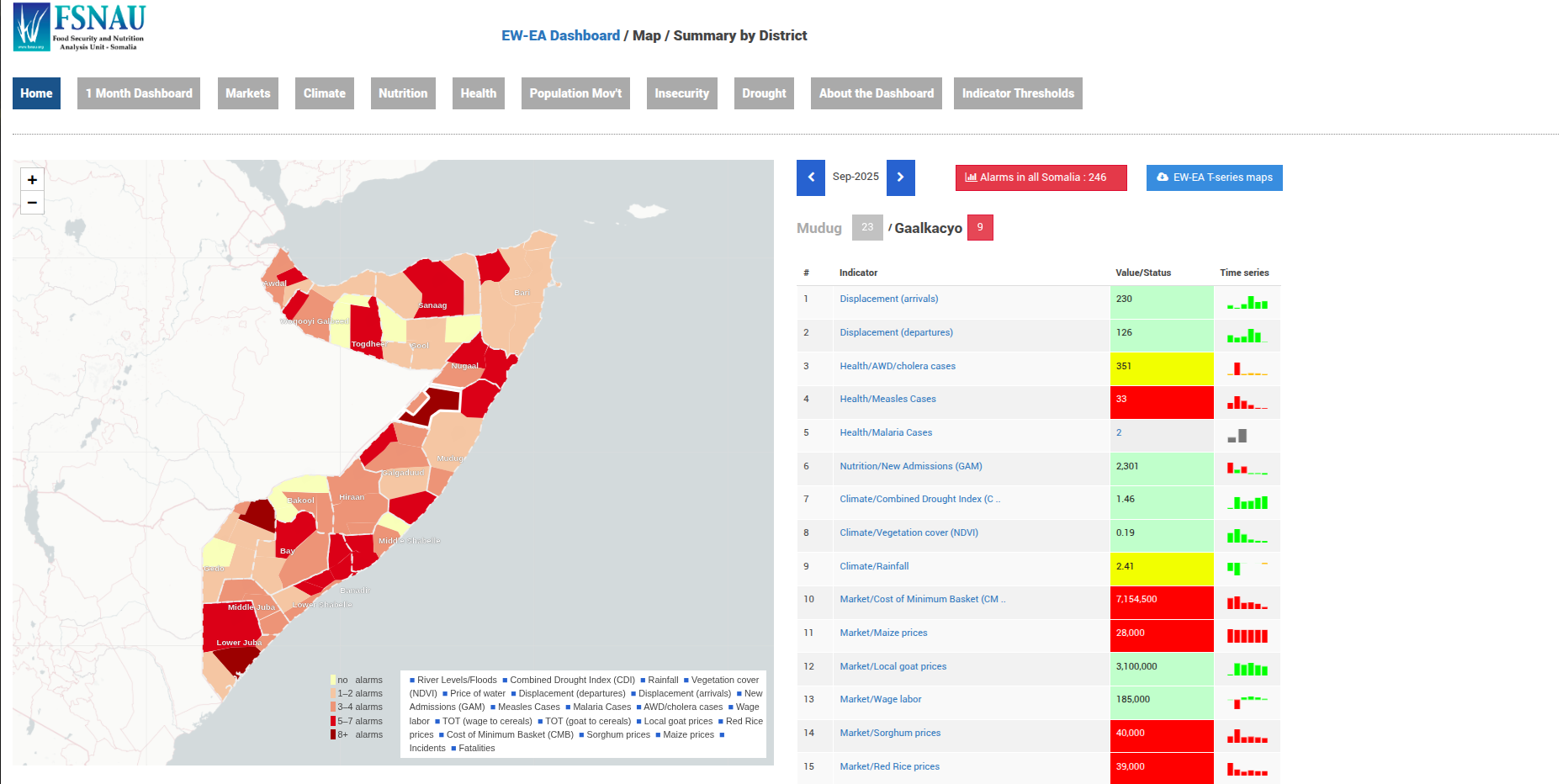
FSNAU Dashboard - Early Warning to Early Action in Somalia
2021: FAO Somalia - FSNAU
A platform for accessing data on a broad range of key early warning indicators to facilitate decision-making.
Skills:
Integrated Food Security Phase Classification (IPC) Early Warning (EW) / Early Action (EA) / Anticipatory Action Flat UI Php Leaflet.js QGIS PostgreSQL- PostGIS Linux Digital Ocean Load Balancing Nginx Vulnerability Mapping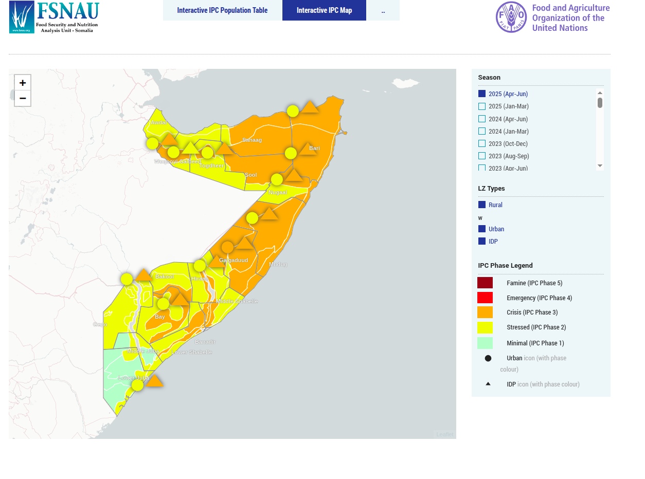
FSNAU Interactive IPC Population Table
2021: FAO Somalia - FSNAU
Interactive IPC Population Table.
Skills:
Integrated Food Security Phase Classification (IPC) Needs Assessment Flat UI Php Leaflet.js QGIS PostgreSQL- PostGIS Linux Digital Ocean Load Balancing Nginx Vulnerability Mapping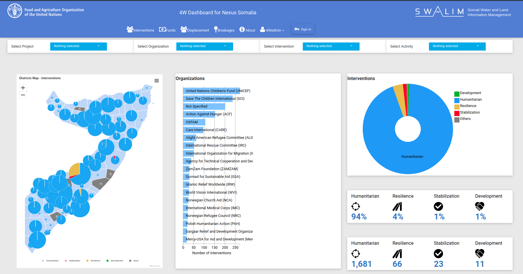
4W Dashboard and River Breakages Dashboard
2021: FAO Somalia
A 4W Dashboard to visualize UN multi-agency and partners’ project activities and status across Somalia.
Skills:
Resource Mobilization Humanitarian Assistance Django D3 Cross-filter RESTful API Leaflet.js QGIS PostgreSQL- PostGIS Linux Digital Ocean Load Balancing Nginx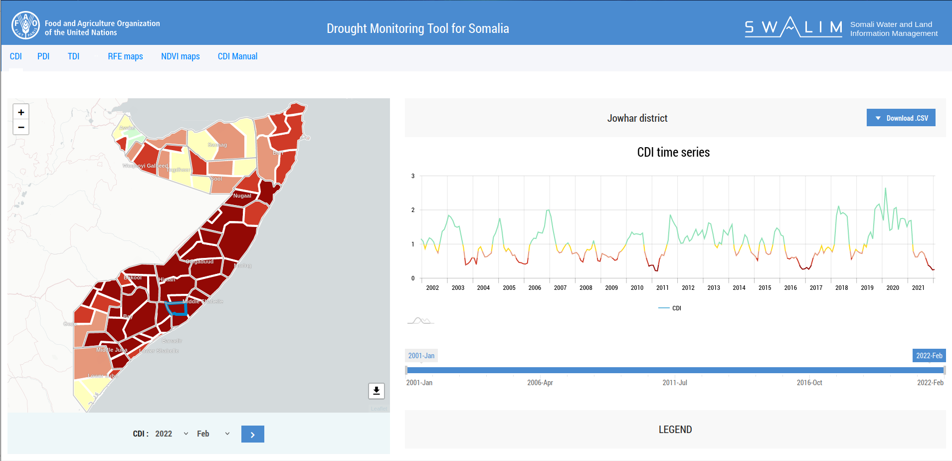
Drought Monitoring Tool for Somalia (CDI)
2021: FAO Somalia
This tool uses three climatic conditions—rainfall, temperature, and NDVI—to monitor drought conditions and estimate the density of greenness in a given area.
Skills:
Drought PHP Vue.js Amcharts Leaflet.js QGIS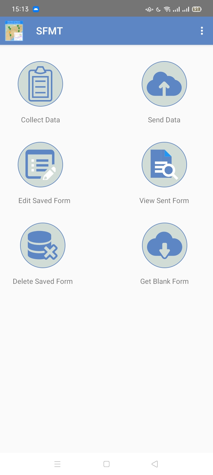
Somalia Flood Monitoring Tool
2021: FAO Somalia
A mobile app developed with ODK for collecting and visualizing flood data on the River Juba and Shabelle to support effective disaster response.
Skills:
Climate & Weather Floods Material Design Python ODK Aggregate GeoDjango Leaflet.js QGIS PostgreSQL- PostGIS Linux Digital Ocean Load Balancing Nginx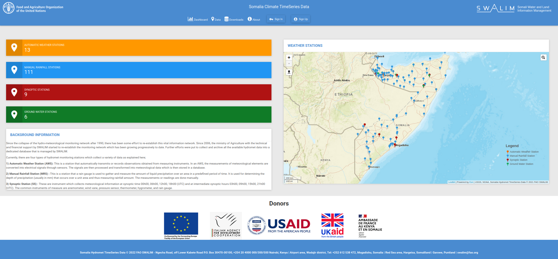
Somali Climate TimeSeries Data
2020: FAO Somalia
A tool for visualizing historical and near-realtime weather information from Automatic Weather Stations, Synoptic Stations, Ground Water Stations and Manual Stations.
Skills:
Climate & Weather Ground Water Material Design Python GeoDjango Leaflet.js QGIS PostgreSQL- PostGIS Linux Digital Ocean Load Balancing Nginx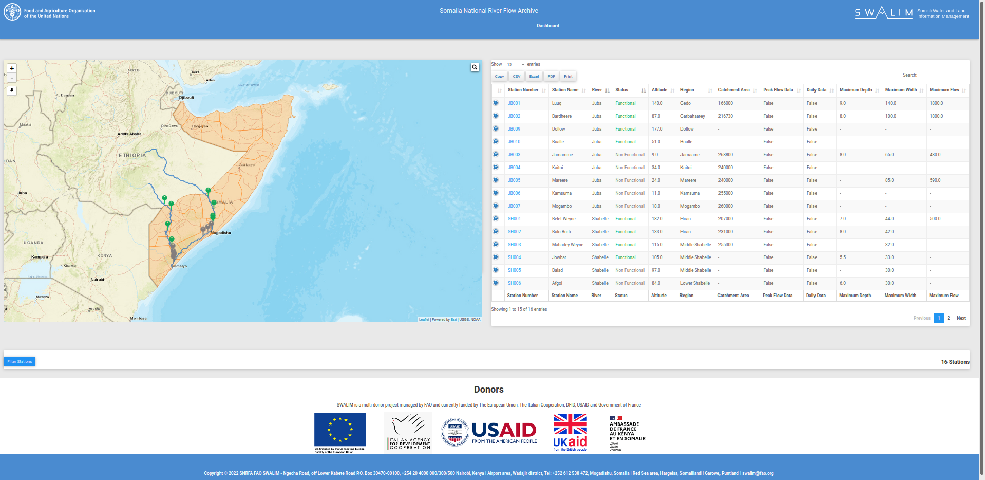
Somali National River Flow Archive
2020: FAO Somalia
A web application tool for visualizing historical and daily river levels and flows.
Skills:
Flooding Material Design Python GeoDjango Leaflet.js QGIS PostgreSQL- PostGIS Linux Digital Ocean Load Balancing Nginx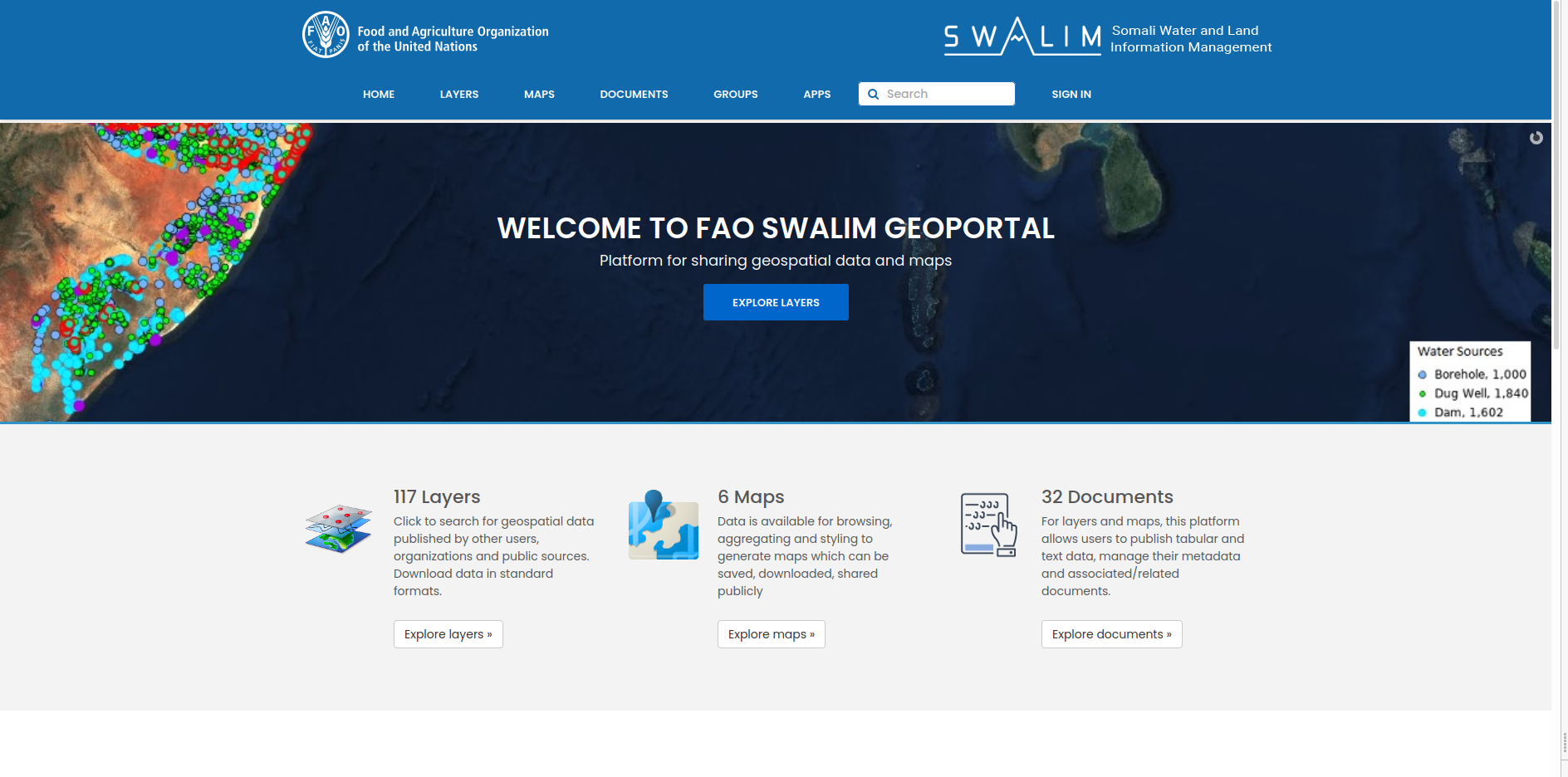
FAO SWALIM Geoportal
2019: FAO Somalia
A Spatial Data Infrastructure for FAO SWALIM to host all the spatial datasets and related documents.
Skills:
Spatial Data Infrastructure GeoNode GeoServer Leaflet.js PostgreSQL- PostGIS GeoDjango RESTful API Linux Digital Ocean Load Balancing Nginx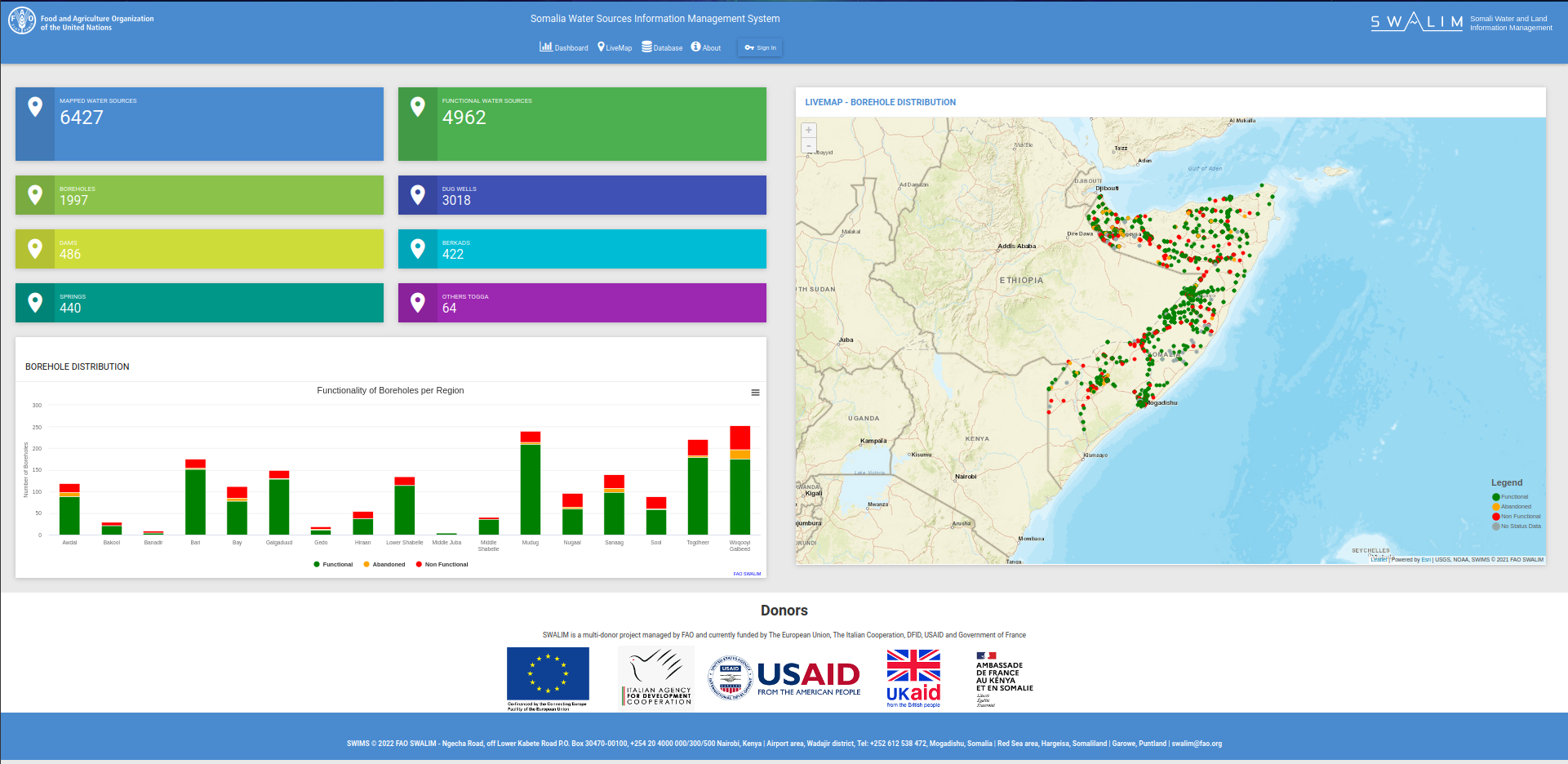
Somali Water Sources Information Management System
2019: FAO Somalia
A platform to visualize number and types of water sources across administrative boundaries of Somalia.
Skills:
Water Sources Python Django Leaflet.js GeoServer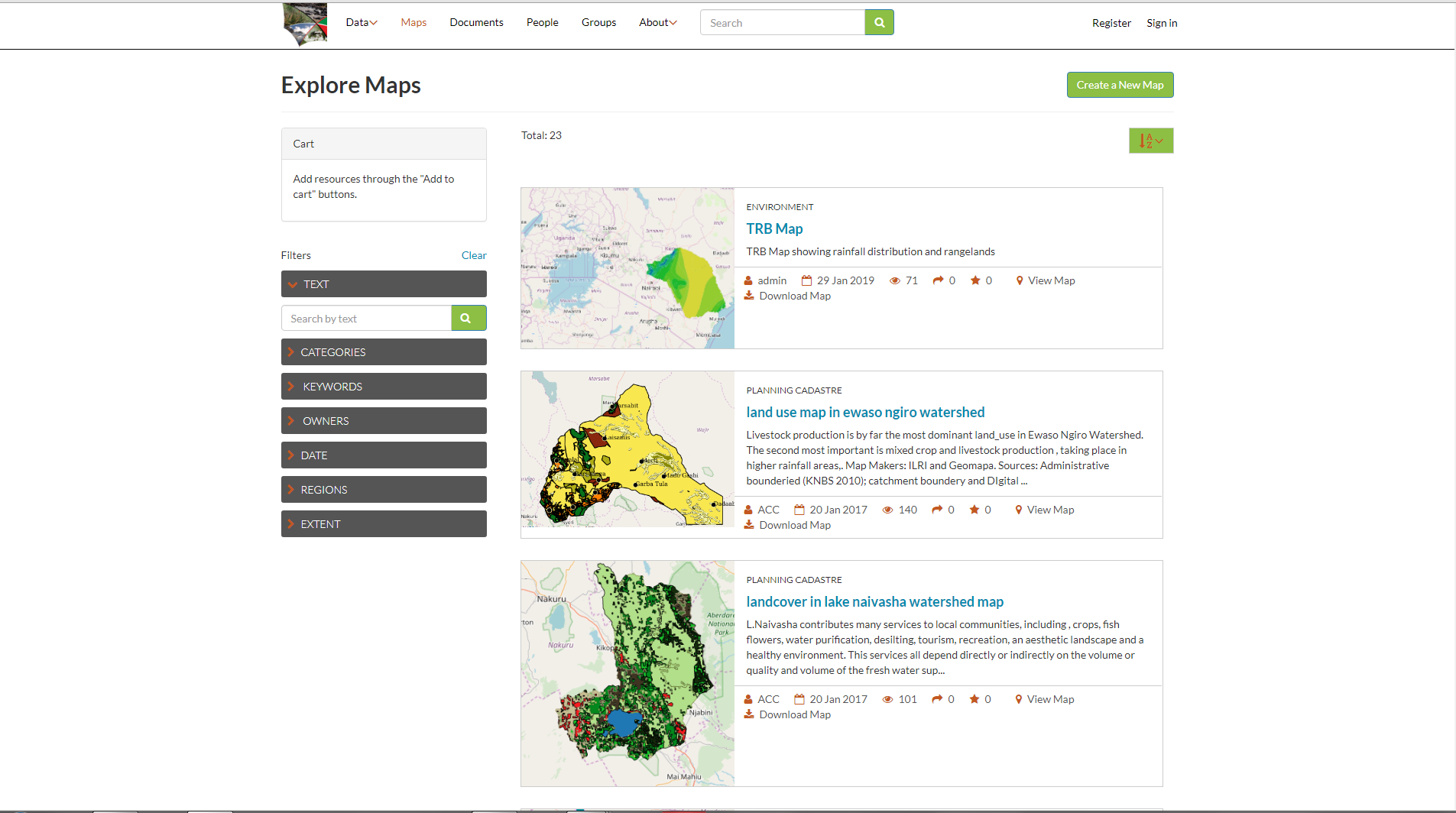
Biodiversity Atlas of Kenya
2018: Upande, Kenya
This tool uses three climatic conditions—rainfall, temperature, and NDVI—to monitor drought conditions and estimate the density of greenness in a given area.
Skills:
Biodiversity Spatial Data Infrastructure GeoNode GeoServer Leaflet.js React PostgreSQL- PostGIS GeoDjango RESTful API Linux Digital Ocean Load Balancing Nginx
Water Sector Trust Fund Portal
2018: Upande, Kenya
WSTF Portal is a custom WaSHMIS GIS implemented for the Water Sector Trust Fund to facilitate management and visualization of spatial data streams in near real time of the Water utilities or mobile data collection activities under the Joint 6 Programme across 6 counties, 32 Water utilities in Kenya.
Skills:
Spatial Data Infrastructure Water Service Providers GeoNode GeoServer Leaflet.js React PostgreSQL- PostGIS GeoDjango RESTful API Linux Digital Ocean Load Balancing Nginx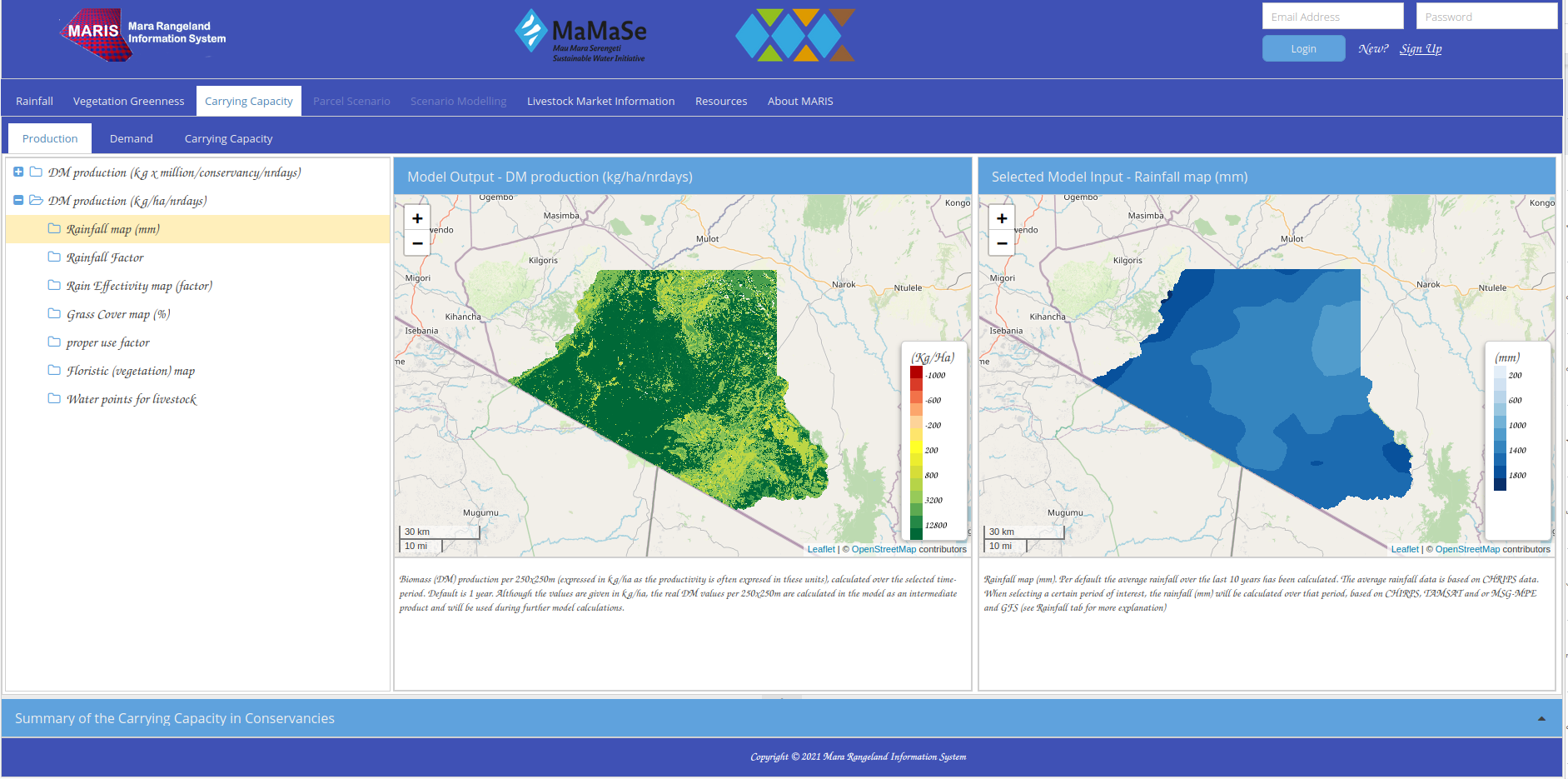
Mara Rangeland Information System (MARIS)
2017: Upande & ITC Enschede
Developed to monitor grasslands and support sustainable pastoral livelihoods using satellite imagery and data modeling.
Skills:
Rangelands IoT Angular Php Python CHIRPS MODIS Sentinel-2 Landsat 8 Livestock Data ODK Python Python ArcGIS Pro ILLWIS Model Builder QGIS uDig PostgreSQL-PostGIS Automated Workflows
WaSHMIS Collect
2016: Upande, Kenya
A mobile application developed using ODK framework to collect Customer Identification Survey information or any other data for Water Service Providers.
Skills:
Spatial Data Infrastructure Water Service Providers XLSX ODK ODK Aggregate GeoServer Python Java
WaSHMIS GIS
2016: Upande, Kenya
WaSHMIS GIS is a web portal to facilitate management and visualization of spatial data streams in near real time of the Water utilities or mobile data collection activities.
Skills:
Spatial Data Infrastructure Water Service Providers GeoNode GeoServer Leaflet.js React PostgreSQL- PostGIS GeoDjango RESTful API Linux Digital Ocean Load Balancing Nginx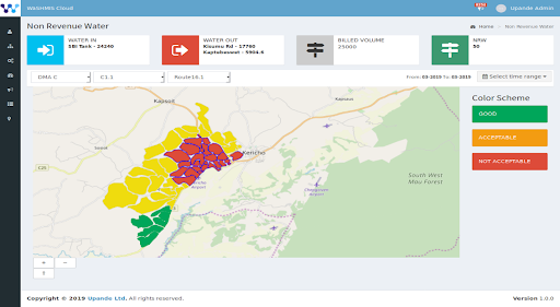
WaSHMIS Dashboard
2016: Upande, Kenya
Platform that enables WSPs data in the cloud or on utility’s infrastructure to be accessed, tracked, updated, and managed through a browser or desktop GIS.
Skills:
Water Service Providers GeoNode GeoServer Leaflet.js React PostgreSQL- PostGIS IoT Sensors RESTful API Linux Digital Ocean Load Balancing Nginx